Enabling fish farming
We respond to the national aquaculture and blue bioeconomy strategies by looking for sea areas suitable for aquaculture, developing cooperation with various stakeholders, and leasing areas suited for fish farming to companies.
The Finnish government has developed several strategies aiming to promote aquaculture and the blue bioeconomy.
- The objective of the Aquaculture Strategy 2022 is to boost Finnish fish farming production
- The Finnish Bioeconomy Strategy (national development plan for the blue bioeconomy 2025) aims for increased self-sufficiency
- The Programme of Measures of the Finnish Marine Strategy 2016-2021 sets targets for marine environment management, including a good status of the marine environment.
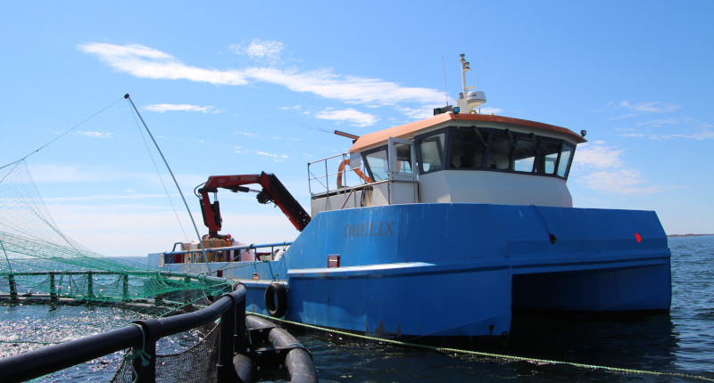
Metsähallitus facilitates fish farming development in public water areas
Metsähallitus manages over 2 million hectares of public sea areas. Its objective is to respond to the national strategies by looking for sea areas suitable for aquaculture, developing cooperation with various stakeholders, and leasing areas suited for fish farming to companies. The search for suitable areas focuses on Metsähallitus’ public sea areas, excluding nature reserves and other sites set aside for special uses of the state.
Metsähallitus participates in a number of projects seeking to resolve aquaculture issues.
Aquaculture Innovation Programme
- Funded by the European Maritime and Fisheries Fund (EMFF)
- The consortium consists of nine partners, including Metsähallitus
- The programme contains actions aiming to develop offshore farming, divided into the following packages: permits and production sites for offshore farming, offshore farming technologies, efficient production cycles and adding value to production, and other targeted innovation actions.
For more information about the Aquaculture Innovation Programme (luke.fi)
The Uki project – Development of a fish farming operating model in the sea area of Uusikaupunki
- EMFF-funded
- Metsähallitus is a member of the project’s steering group
- The project aims to develop an operating model for fish farming, divided into the following packages: central/local government as an applicant for an environmental permit (alternative operating models), examination of areas suitable for different production phases (hatcheries, grow-out, overwintering, port operations), and production of the information required for an environmental permit application.
Further information about Fish farming in Finland (kalankasvatus.fi, pdf)
Kalavaltio project
- EMFF-funded
- In partnership with Natural Resources Institute Finland, Finnish Environment Institute and Metsähallitus
- The project investigates the suitability of state-owned public water areas for fish farming and develops a spatial plan for aquaculture (FINFARMGIS, a spatial planning tool for fish farming based on an ecosystem approach)
The projects discussed above complement each other. For example, the Kalavaltio project uses the FINFARMGIS geospatial data application created in the Aquaculture Innovation Programme to examine the suitability of sea areas for fish farming.
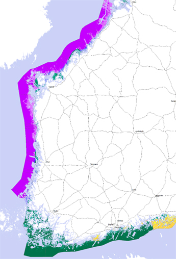
Participation in maritime spatial planning
The purpose of maritime spatial planning is to promote sustainable development and growth for different uses in the marine region, the sustainable use of natural resources, and achievement of a good status of the marine environment.
Finland’s first maritime spatial plan was completed in 2020. Continental Finland’s plan consists of three plans: one of the plans includes the Gulf of Finland, the other the Archipelago Sea and the Southern Bothnian Sea, and the third the northern Bothnian Sea, the Kvarken and the Gulf of Bothnia. Åland drew up its own plan.
The plans for mainland Finland were drawn up under the leadership of the regional associations in extensive co-operation with stakeholders. They reconcile the needs of different industries, including energy, maritime transport, fisheries and aquaculture, tourism and recreational use. They also focus on conservation, protection and improvement of the environment and nature.
More information about maritime spatial planning (meriskenaariot.info)
Contact details
Jani Viisanen